Property Record
135 Gateway Ct, Lenoir, NC 28645
NEARBY LISTINGS FOR SALE OR LEASE
-
-
View all Lenoir listings for sale on LoopNet.com
Property Detail
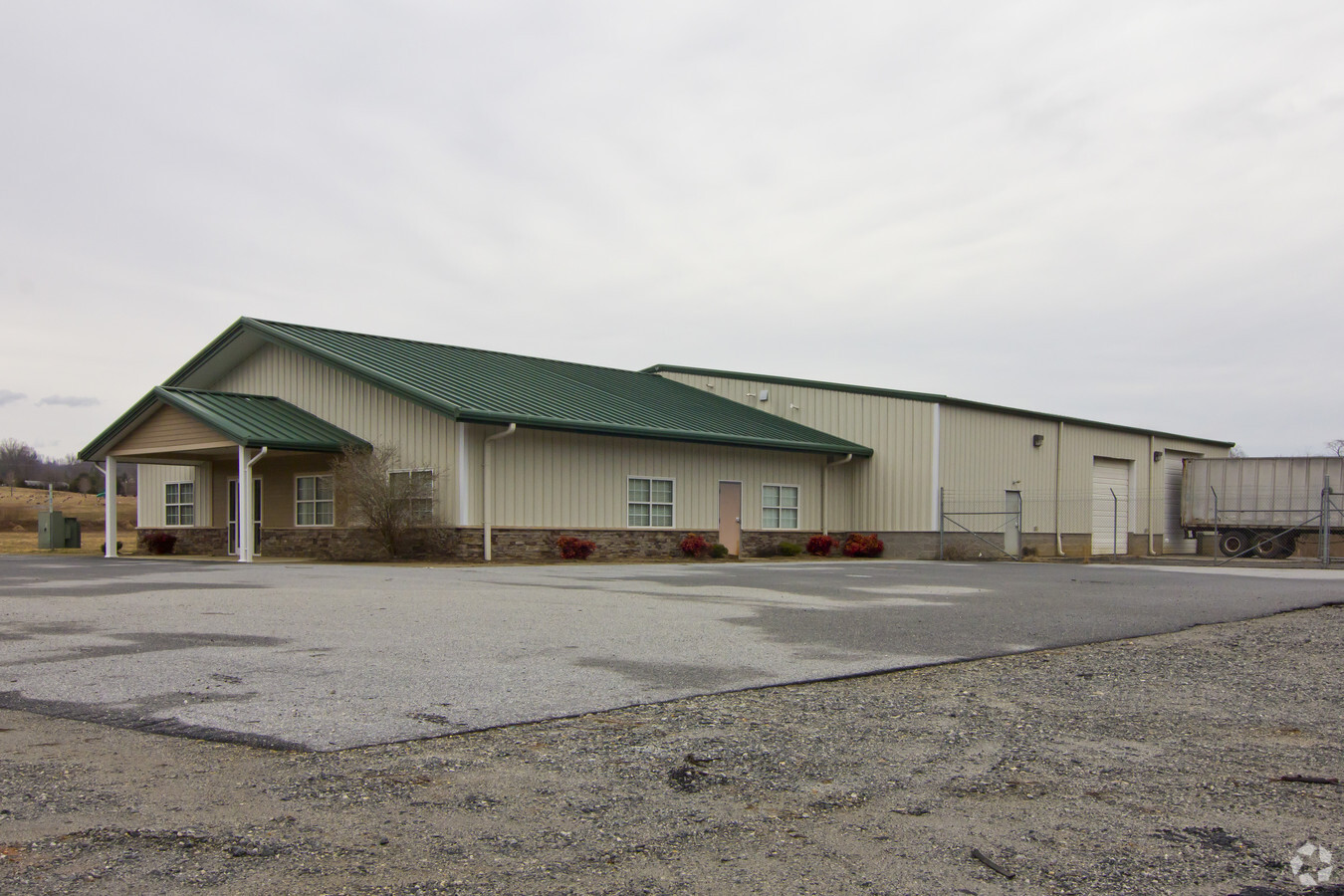
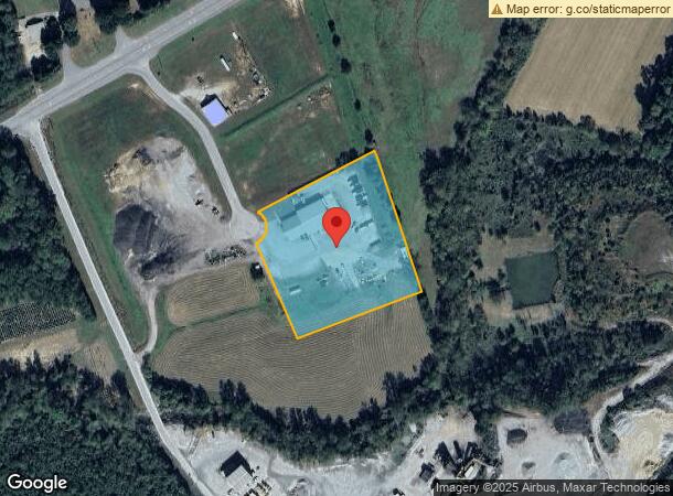
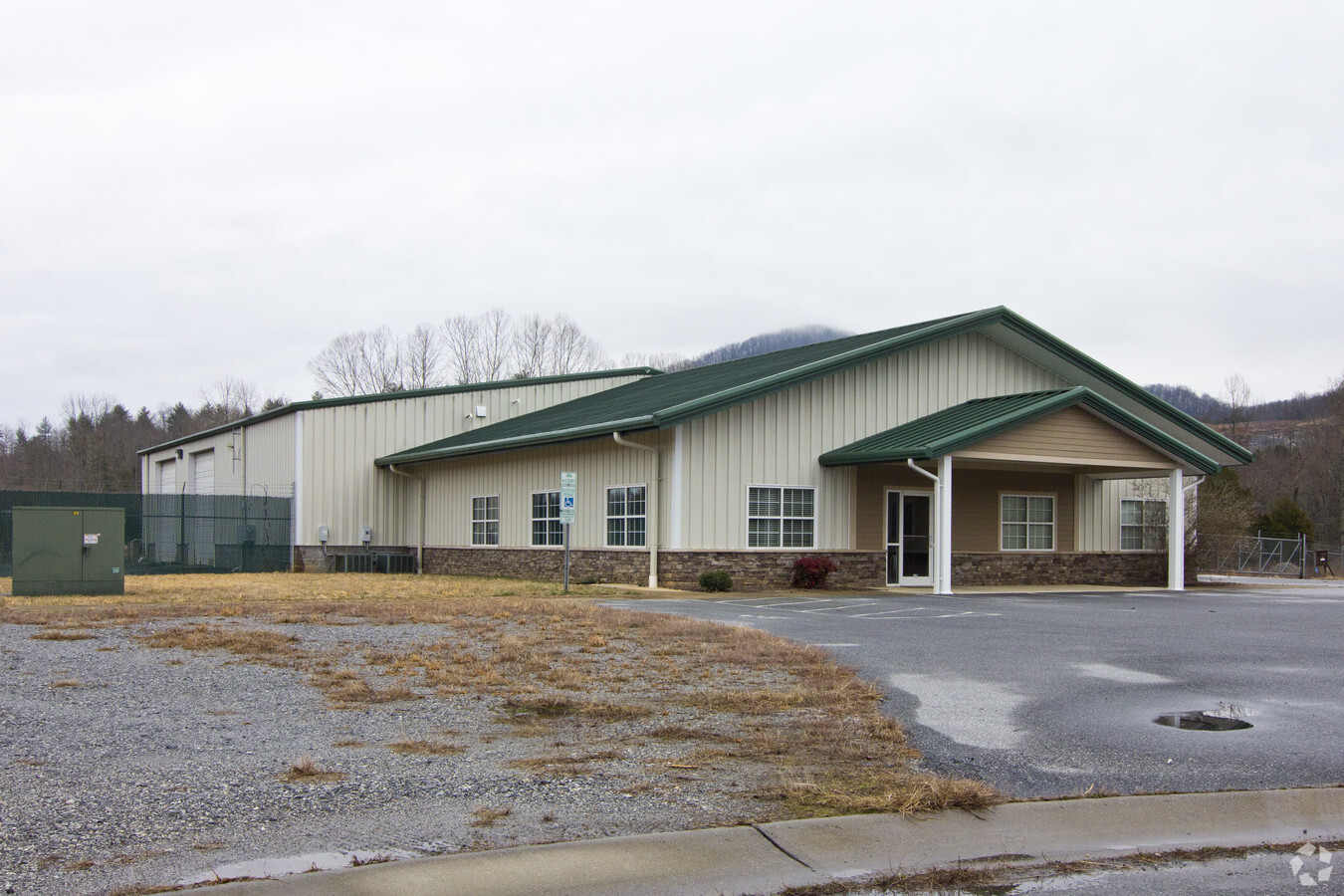
135 Gateway Ct
09102-3-4
Cedar Rock Industrial Park Subdivision
Warehouse
BK 2103 PG 873 YR 24 ST 810.00
AE
Caldwell
3710286000J
North Carolina
2024
3.51 AC
2024
Caldwell County
031201
Charlotte
8,563 SF
Hickory-Lenoir-Morganton, NC
DEMOGRAPHICS near 135 Gateway Ct
1 Mile
3 Mile
5 Mile
2024 Total Population
806
8,365
23,977
2029 Population
800
8,358
23,982
Pop Growth 2024-2029
(0.74%)
(0.08%)
+ 0.02%
Average Age
47
45
43
2024 Total Households
336
3,535
10,085
HH Growth 2024-2029
(0.89%)
(0.11%)
+ 0.01%
Median Household Inc
$65,000
$53,516
$39,064
Avg Household Size
2.30
2.30
2.30
2024 Avg HH Vehicles
2.00
2.00
2.00
Median Home Value
$238,835
$219,826
$156,848
Median Year Built
1983
1979
1973
Nearby Places
- Restaurants
- Banks
- Shops
- Fitness
- Groceries
Nearby Properties
Address
Land Use
TOTAL SIZE
Lot Size
Zoning
Address
Land Use
TOTAL SIZE
Lot Size
Zoning
147,756 SF
108.33 AC
Address
Land Use
TOTAL SIZE
Lot Size
Zoning
206,330 SF
28.99 AC
Address
Land Use
TOTAL SIZE
Lot Size
Zoning
47,787 SF
18.01 AC
Address
Land Use
TOTAL SIZE
Lot Size
Zoning
39,127 SF
13.06 AC
Address
Land Use
TOTAL SIZE
Lot Size
Zoning
96,873 SF
15.85 AC
Address
Land Use
TOTAL SIZE
Lot Size
Zoning
54,363 SF
3.59 AC
Address
Land Use
TOTAL SIZE
Lot Size
Zoning
29,794 SF
18.77 AC
Address
Land Use
TOTAL SIZE
Lot Size
Zoning
142,272 SF
42.94 AC
Address
Land Use
TOTAL SIZE
Lot Size
Zoning
35,855 SF
17.80 AC
Address
Land Use
TOTAL SIZE
Lot Size
Zoning
6,602 SF
18.15 AC
Address
Land Use
TOTAL SIZE
Lot Size
Zoning
55,073 SF
4.18 AC
Address
Land Use
TOTAL SIZE
Lot Size
Zoning
40,794 SF
2.07 AC
Address
Land Use
TOTAL SIZE
Lot Size
Zoning
1,620 SF
1,084 AC
Address
Land Use
TOTAL SIZE
Lot Size
Zoning
52,519 SF
6.31 AC
Address
Land Use
TOTAL SIZE
Lot Size
Zoning
54,705 SF
6.25 AC
Address
Land Use
TOTAL SIZE
Lot Size
Zoning
21,568 SF
1.71 AC
Address
Land Use
TOTAL SIZE
Lot Size
Zoning
58,145 SF
11.17 AC
Address
Land Use
TOTAL SIZE
Lot Size
Zoning
28,426 SF
10.79 AC
Address
Land Use
TOTAL SIZE
Lot Size
Zoning
3,200 SF
4.26 AC
Address
Land Use
TOTAL SIZE
Lot Size
Zoning
14,250 SF
2.11 AC
Address
Land Use
TOTAL SIZE
Lot Size
Zoning
23,966 SF
113.36 AC
Address
Land Use
TOTAL SIZE
Lot Size
Zoning
5,218 SF
2.39 AC
Address
Land Use
TOTAL SIZE
Lot Size
Zoning
25,020 SF
5.44 AC
Address
Land Use
TOTAL SIZE
Lot Size
Zoning
13,445 SF
0.60 AC
Address
Land Use
TOTAL SIZE
Lot Size
Zoning
14,736 SF
1.56 AC
Address
Land Use
TOTAL SIZE
Lot Size
Zoning
19,467 SF
6.02 AC
Address
Land Use
TOTAL SIZE
Lot Size
Zoning
33,108 SF
3.89 AC
Address
Land Use
TOTAL SIZE
Lot Size
Zoning
53,693 SF
13.89 AC
Address
Land Use
TOTAL SIZE
Lot Size
Zoning
17,328 SF
2.08 AC
Address
Land Use
TOTAL SIZE
Lot Size
Zoning
9,940 SF
1.14 AC
The World's #1 Commercial Real Estate Marketplace
Connect with us
© 2025 CoStar Group
The information above has been obtained from sources believed reliable. While we do not doubt its accuracy we have not verified it and make no guarantee, warranty or representation about it. It is your responsibility to independently confirm its accuracy and completeness. Any projections, opinions, assumptions, or estimates used are for example only and do not represent the current or future performance of the property. The value of this transaction to you depends on tax and other factors which should be evaluated by your tax, financial, and legal advisors. You and your advisors should conduct a careful, independent investigation of the property to determine to your satisfaction the suitability of the property for your needs.